 |
| http://www.plumberorangecountytanklesswaterheaterslableakrepairpipessewer.com |
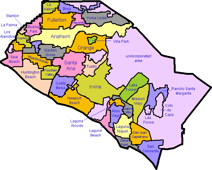
This map was from a plumber's website, and it seems that it is used to show that they work everywhere in Orange County. The map shows all the cities in Orange County and shades each city with a different color. I find this map interesting because I am from Orange County and never really looked closely at a map of my home area before. I chose this map in particular because it is easy to read, and shows only what I am looking for. For example, there were other maps of Orange County that I found which included freeways, rivers, and landmarks, but I was only interested in the boundaries and names of the cities so I chose this one.
 |
| http://www.new-york-city-map.com/manhattan.htm |
This map to the right is of the Manhattan burrow of New York City. It was taken from a New York map website, and shows all the streets in the crowded region as well as the main landmarks and neighborhoods. I chose this map because I visited New York City last spring break and was fascinated by the layout of the city, and this map did a great job of showing the intricate complexities of Manhattan. It's really interesting to see how all the streets line up and the extreme organization and planning that was needed to design Manhattan's transportation system.
 |
| http://www.picturesdepot.com/places/19612/disneyland+map.html |
This image was taken from a website with archives of pictures, and this map shows the different areas inside of Disneyland. I chose this map because I grew up about fifteen minutes away from Disneyland and used to visit it multiple times a summer with my grandparents. Looking on this map now, I see how structured it is, and as a small boy I never knew where I was; I would just follow my grandparents and older brother around. I like how the map is drawn, and not an actual image that is to scale. It gives it a friendly feeling, after all, it IS the happiest place on earth...